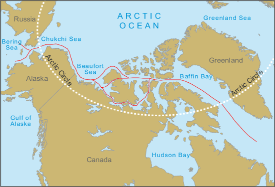
Weather has turned noticeably colder as we are now 71 degrees north. Cooking is on a throretical rotation - though of the five on board clearly three of us prefer to do the job to ensure the galley output is more imaginative than a mixed variety of cans being thrown in one pan. Likewise cleaning appears to be the forte of the same three people. Though I have learnt that the ships 'paprika' is of a very hot nature - and should be used sparingly. The skipper had to run cold water through his sausage casserole this evening. Ice throughout the day has been sighted. Though very light in density and coverage, the horizon appears at times to be entirely blocked by a long, low line of ice. As we approach, with improved focal depth wide paths between bergs can be found. In fact much of this is 'brash' ice - where everything from small bergs the size of a house, to slush which is all but dissipated into the sea exists together. These ice patches come in long ribbons, after which clear seas are experienced for many miles before another ice ribbon is found.
We are heading towards Barter Island as there is a forecast NE force 6-7 expected at the end of the week and the consensus is we will make little progress beating upwind into those conditions. Barter Island has limited anchoring possibilities and is shallow but is our best option. Also, depending on the conditions it may be a refuelling opportunity.
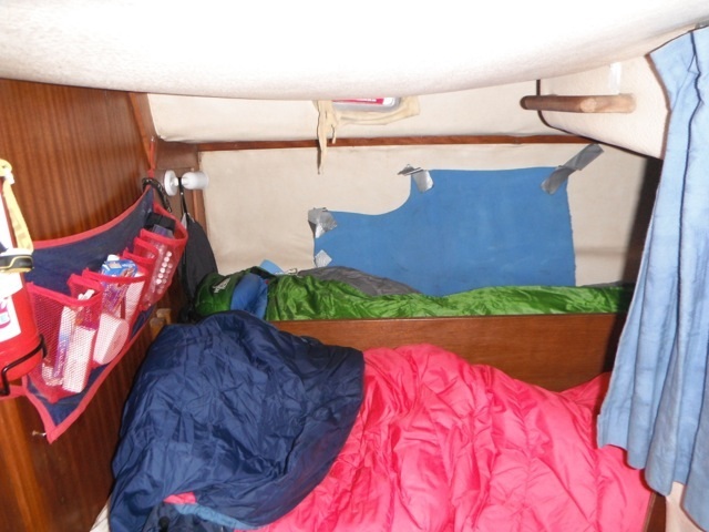
The onboard dynamics of the crew are unfolding. With such a small living space, and people who have been thrown together for only one reason - to complete the NW Passage adventure, the smallest thing can spark dissatisfaction. It was one of my interests in doing this trip to determine these traits. Unlike my previous offshore experiences, such as the round the world race, we have had no time to get to know one another. On the Whitbread (now Volvo Ocean Race) you work with one another for many months before the actual race and by the time you cross the start line the team is just that, and the job of the skipper has been to ensure a crew that works well together. On this adventure that has never been done.
We have passed the Oilfields of Prudhoe Bay to the south, one large oil rig with attached accommodation platform rising out of the Arctic Ocean, lit up like a Christmas tree just a few miles off and a harsh place for the workers.
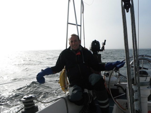
Wind and seas built steadily from the NE. Progress to the east being hampered and our bearing (direction) falling too far to the south bringing the dangers of shallow water and a lee shore. We are about 50 nm from Barter Island where we are to take what little shelter it offers. We spent the day motor sailing into the head seas, our speed often dropping to just 1 or 2 knots as we rose and crashed into short 3m seas. The result is water crashing over the decks and with all hatches closed the cabin isn't a great place to be resting. I am grateful for my diligence ensuring I brought the right clothing. Some of the crew are ill supplied, wearing gloves that are not waterproof, short sea boots not long, oilskins which are better designed for mountains than oceans and thermals which don't dry quickly.
We arrived at Barter Island in Thursday evening. There were two barges and accompanying tugs here. Via VHF radio discussion and one investigative attempt we opted to anchor away from the settlement, by approx. 3 miles in an area of better shelter from the forecast Easterly winds. The water was shallow, so despite being half a mile off the beach, we anchored in 4 metres of depth. We ran 40m of chain (10:1 versus the cruising yachtsman's theory that only 3:1 is needed). This proved to be a wise choice over the coming 36 hours as the wind built and the swell increased.
Thursday was spent at anchor. Bread was made, the boat aired and the heater run for an hour. What little we can see of Barter Island indicates that there is plenty of investment here - modern warehouse units, radio masts, domes and antenna indicates that it has a military purpose. The forecast was looking good for a Sunday departure.
Early Saturday we received an updated weather forecast which indicated light NE or E winds to 10 knots. Whilst this would mean motoring in order to make progress, at least it was possible to make some further eastward progress. We left early with the opportunity to make for Demarcation Bay (located at the border of Alaska USA & Yukon Canada 150 miles east), or Herschel Island (200 miles) or if the forecast changed slightly we could get to the ideal place of Tuktoyaktuk ("Tuk"). Tuk is a fairly large settlement where we have always planned to have our main resupply (fuel, water & stores). It has a safe harbour where we can tie up alongside.
Fog continues to drift in and out of our lives, sometimes just for a few minutes, other times lasting for hours. On Saturday, whilst on deck I spotted an odd looking head pop out of the sea. At first glance I thought it to be an albino seal! On checking with the others we agreed it to be a small Beluga Whale, which are white in colour. Sunday morning the depth sounder played tricks on us. In the main, the western side of the Arctic ocean is very shallow. We are often well off shore in only 4 or 5 metres. However on Sunday clearly the echo sounder got a shock when we passed over a fault ledge and the depth plunges from 30m to 140m in a very short distance. From there on it decided to measure the depth randomly from less than a metre to more than a hundred. As shallow waters can be expected, but because the sea state had not altered significantly (shallow water often increases breaking seas) we carried on with a cautionary check the traditional way using a lead and line (or in our case a heavy shackle and line).
As we approached Tuktoyaktuk at 69 deg 27" N 132 deg 58" W the charts are littered with "Pingo's". These resemble - at least on a chart - the top of an underwater volcano or atoll. They are in fact ice -dome hills, found both at sea and on the adjacent land. They are formed by ground ice (i.e subterranean) which forms during the winter and pushes the surface up - whether above or below sea level. Up to 70m in height and 600m diameter they can be a sudden surprise if not carefully navigated around.
Monday 19th August
We arrived in Tuk in the early hours. Now 2 hours forward in time (BST now +7 hrs). The complex entrance to the natural harbour displayed the first navigation lights and bouys we have seen in 1300 nm. We anchored on the main bay in order to get some sleep before morning when we motored alongside the small concrete pier. Tuk is a small town, population less than 1000 but has a lovely feel, friendly people and whilst the landscape remains low, bleak and with little vegetation it resembles more of a Scandanavian feel than the places visited in North Alaska to date. Tuk has become known to many outsiders as one of the challenging destinations for the popular TV documentary drama "Ice Road Truckers". During the day we refuelled, fortunately the petrol station is located 100m from where the boat is moored. The locals often walking down to say hello and enquire about our trip.
We are now investigating the area, seeking wifi and hot showers - comforts we haven't for a few weeks (my last shower was three weeks ago today).
All the best
Richard


 RSS Feed
